Arcad Ingénierie
3D Scanning in Reunion Island
ARCAD Ingénierie is a consulting company specialized in 3D data collecting and processing. Based in Reunion Island, we conduct surveys all across the Indian Ocean for all types of projects : architecture, construction, industry, archeology, heritage conservation etc.
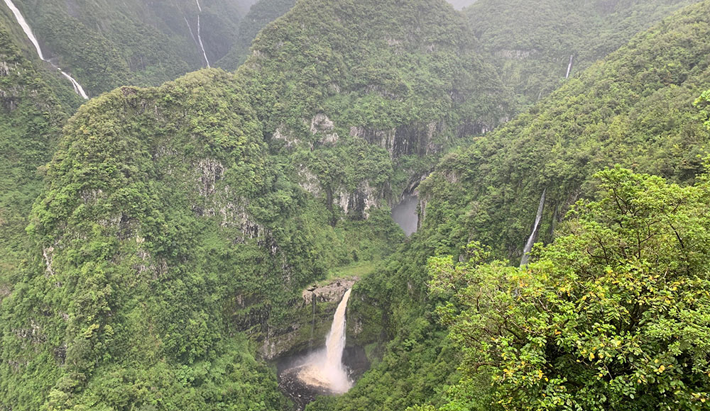
Since 2017, we have been equipped with a complete LIDAR system which enables us to digitize large, inaccessible or dangerous areas, such as ravines, cliffs etc.
Contact usPoint cloud
What is 3D scanning ?
3D scanning is a process model/that allows contactless measurement of the shape and color of an object’s surface to create a digital replica. It is one of the many specializations of surveying. Different tools can be used, such as a camera, LiDAR system or 3D laser scanner.
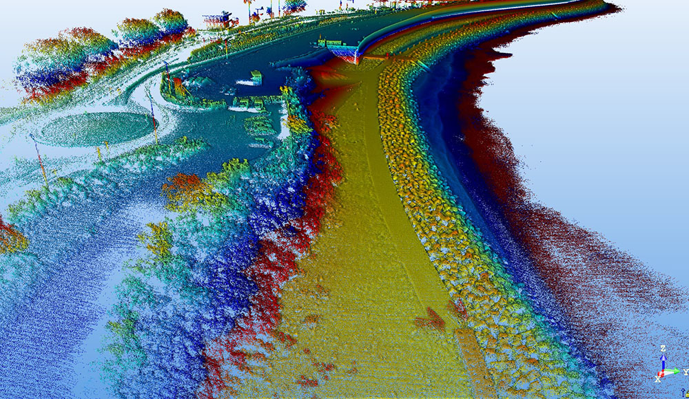
Specifically, lasergrammetry or remote detection is the process of measuring an environment using a 3D laser scanner or LIDAR. These are laser scanning tools capable of measuring millions of points within a short time. The collected data provides virtual representation of reality as 3d point cloud, colored or uncolored.
From databases to preventive maintenance, technical expertise or structural projects integration in complex environments (such as industrial factories), 3D scanning is the technology that is revolutionizing topography.
ARCAD ingénierie uses two different tools for its surveys : the 3D laser scanner and the LiDAR system. The former is a static measurement tool that needs to be moved multiple times until we obtain a full digitization of the area. The latter is dynamic and put aboard on a vehicle, drone or helicopter : it collects data while following a specific path.
-
Concerned industry sectors
Manufactoring, Maintenance, Energy, Public works, Civil engineering, Renovation, Consulting companies, Engineering, BIM, Archeology, Heritage conservation, Environment, Geology, Architecture, Insurance companies, Forensic, Hydraulic, Agriculture, Disaster risk management.
-
Digitization examples
Quarry, ravine, excavation, rock formations, rockfill, levee, tunnel, road, building, infrastructure, tank, pipe, tuyauterie, framework, accident, structural damage …
What is a LiDAR system ?
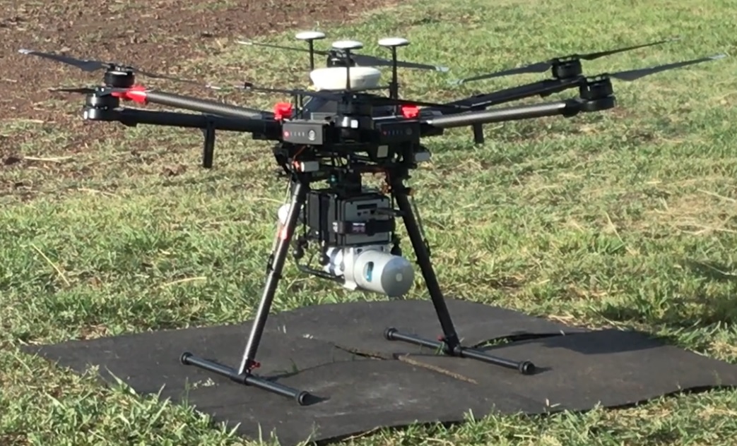
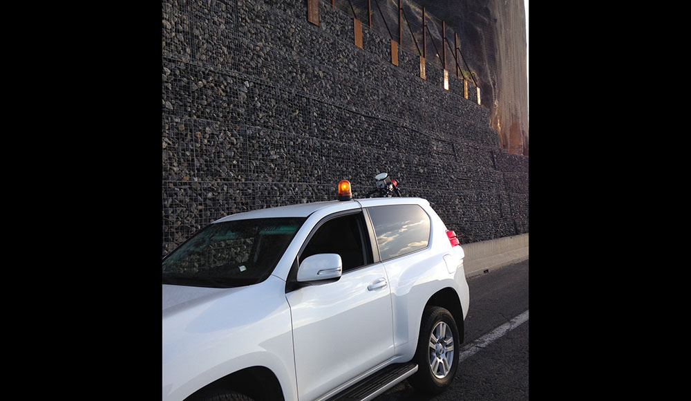
Laser remote sensing or LiDAR (Light Detection And Ranging) is a measurement technology based on analyzing the properties of a light beam reflected back to its sensor. Our first AL3-32 LiDAR (Velodyne’s HDL-32E lidar sensor) is a cutting-edge technological tool.
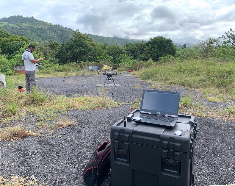
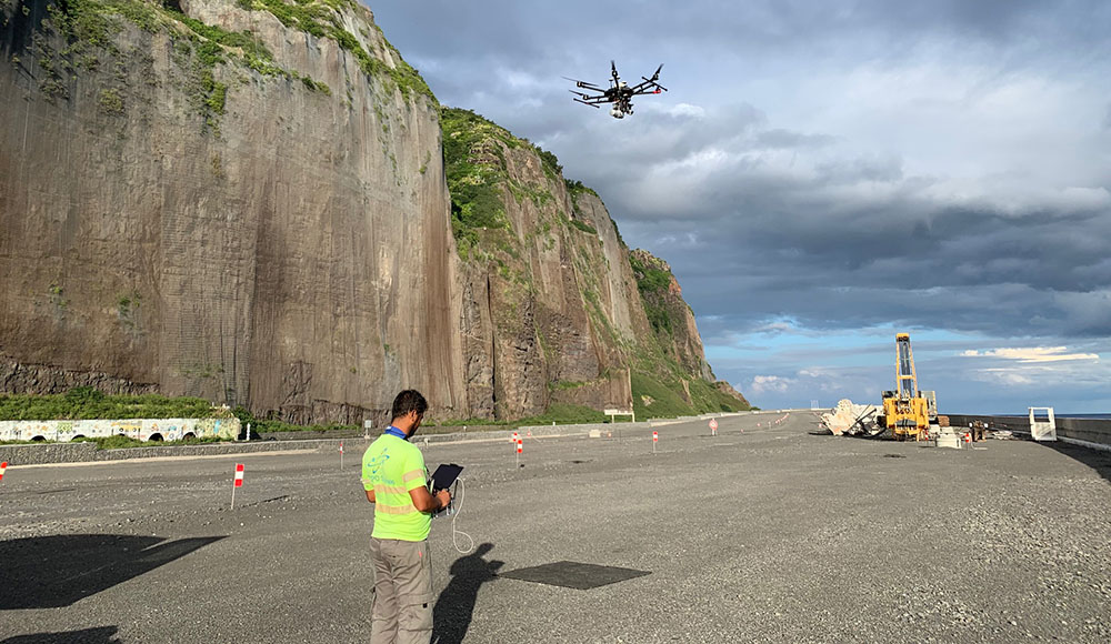
It can be attached to a car, but also to our DJI M600 drone thanks to its small size. With it, we can conduct aerial laser surveys and obtain geo-referenced 3D point clouds directly.
Thanks to this system which benefits from the advantages of drone surveying, we are pioneers all across the Indian Ocean to provide LiDAR survey services by drone.
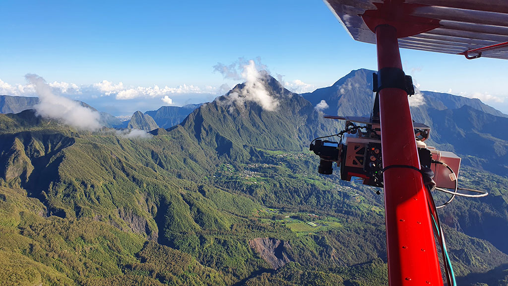
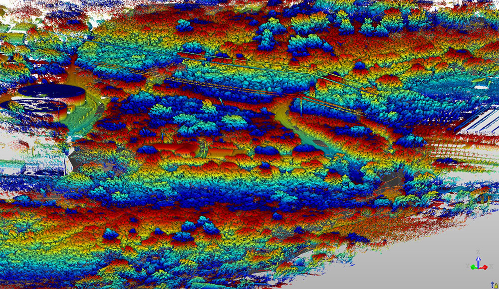
Our second LiDAR system, a VUX240 Riegl coupled with an AP60 inertial measurement unit, embarked under a helicopter or ultralight aircraft, allows us to conduct surveys on a very large urban or non-urban areas, freeing us from drone legislation constraints. This LIDAR has an acquisition speed of around 1,500,000 points per second and up to 15 echoes for better penetration through vegetation.
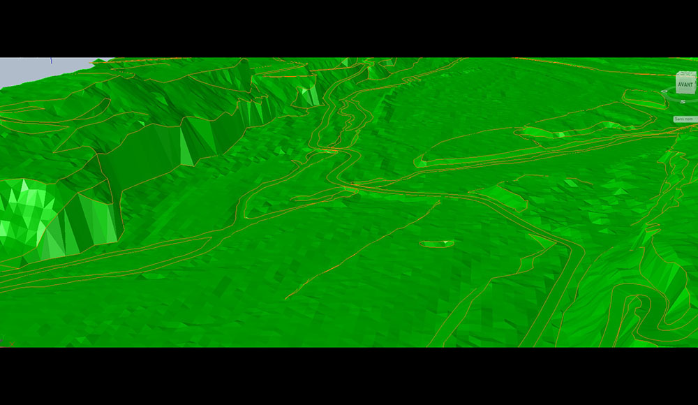
Those tools are used to map and create Digital Terrain Models (DTM). The benefits of the system are numerous :
-
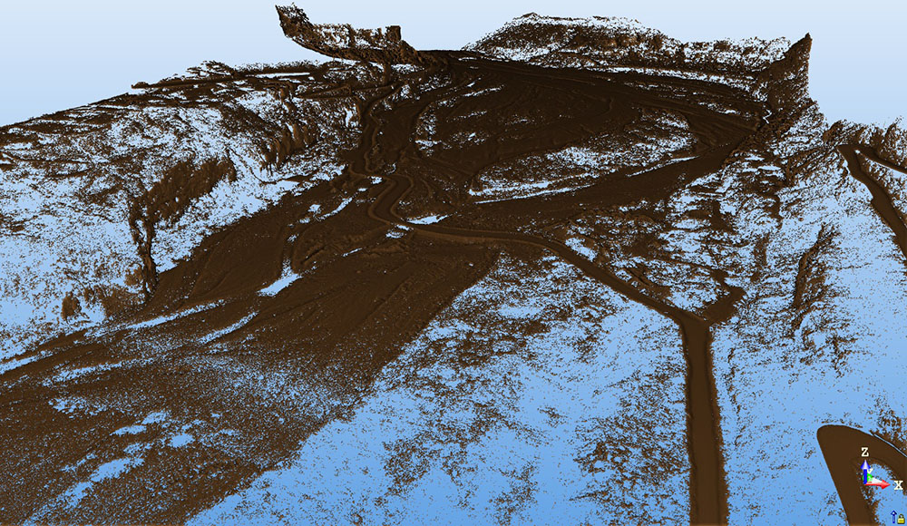
No hindrance due to vegetation
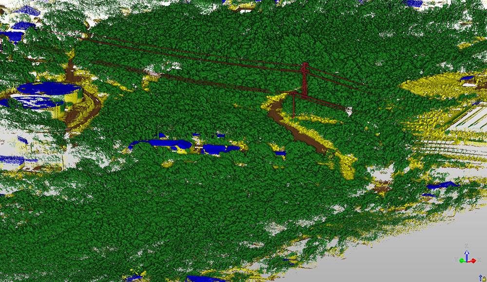
Unlike photogrammetry surveying, LiDAR surveying and its echo technology allows us to see through vegetation and to map accurately the terrain as it is.
-
Very fast digitization
With up to 1.5 million points recorded per second, our LiDAR systems can measure large areas very quickly.
3D scanning pros and cons
The pros of those surveying techniques are many : Time saving on the field – Measurement precision – Survey exhaustiveness – Survey error removal – Project cost reduction – Time and error savings in engineering studies – Digital validation of the project – Possibility of night survey – Survey of structures and roads under traffic (no need to stop road traffic).
The cons depend on the tool (range and precision) and on the intended use, as the tool must always be adapted to the desired result. Moreover, it is important to note the necessity of powerful and expensive professionnal softwares for processing data from scanning, as data acquisition only represents about 20% of the work !
Our technical equipment
With a large set of tools and data processing softwares at our disposal, our team will be able to adapt their equipment to your project constraints, ensuring the survey results reliability. However, as topography is not an exact science, even with such equipment, control and error detection remain our top priority, ensuring quality for our clients. You will find below our different analysis and measuring tools :
-
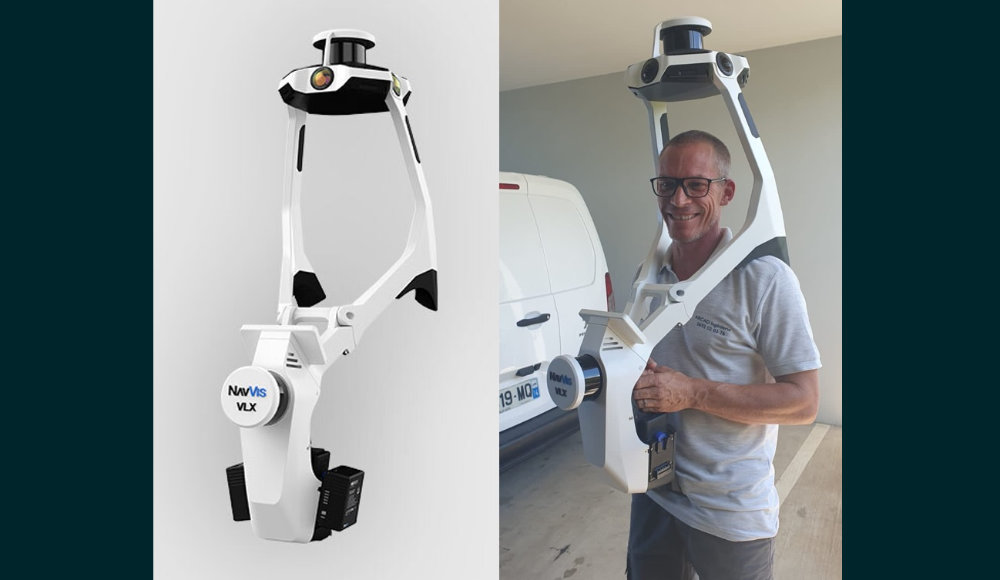
1 dynamic laser scanner
NavVis VLX 3
-
2 laser scanners
Trimble TX5, Faro Focus S350
-
2 complete LiDAR systems
1 Veylodine HDL32E et 1 Riegl VUX240
- 1 DJI M600 Pro drone
- 1 GS18 Leica GPS
-
Softwares
Trimble Realworks, Spacial Explorer / Lighthouse / Fuser, Inertial Explorer, Autocad 2022, Autodesk ReCap, POS PAC, Riegl Softwares, Terrasolid
The acquisition of teledetection tools (high density LiDAR system) is co-financed by the European Union and the Reunion Island Region.
Our partners
eBim Ingénierie
Consulting firm specialized in BIM Management and digital 3D modeling. eBIM Ingénierie mainly helps us in the conception of 3D models based on point clouds.
See their website (french speakers only)Some of our works
3D scanning
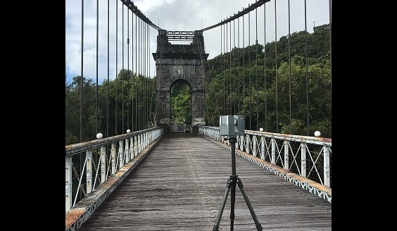
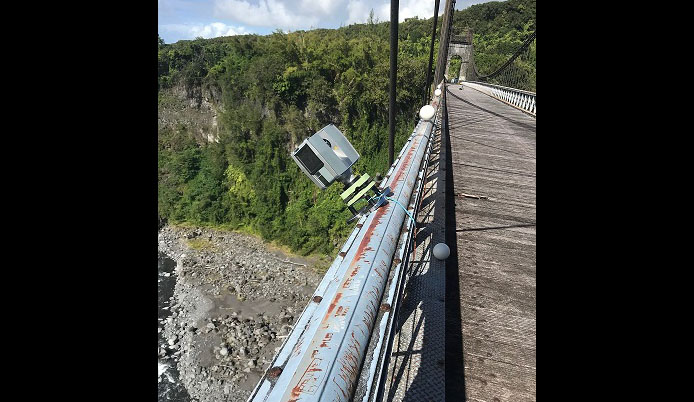
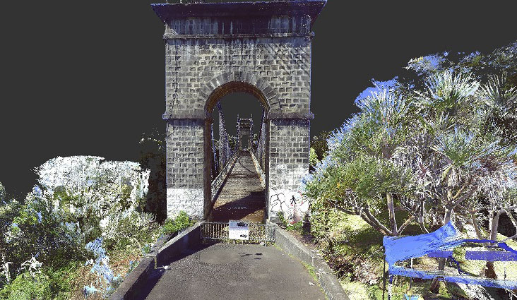
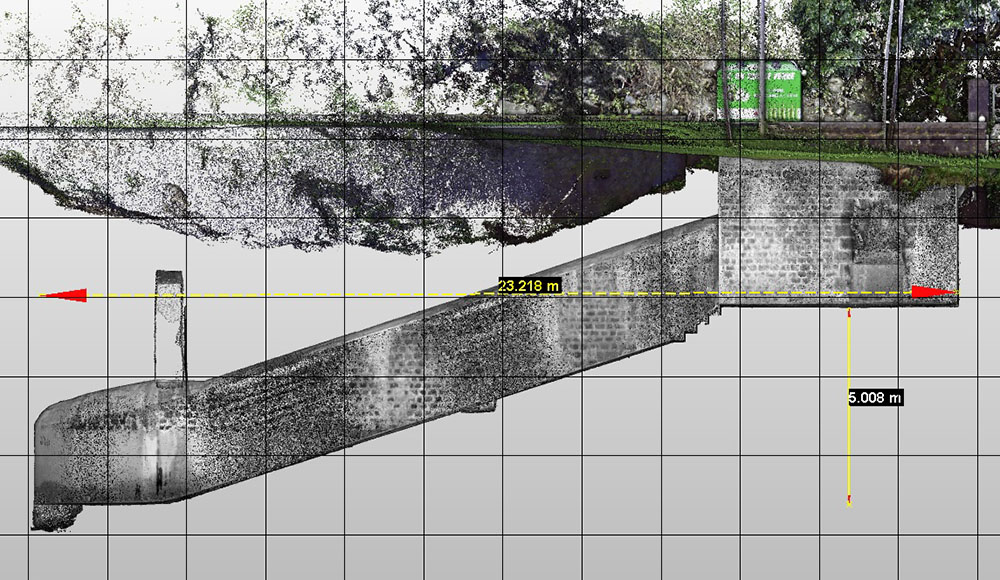
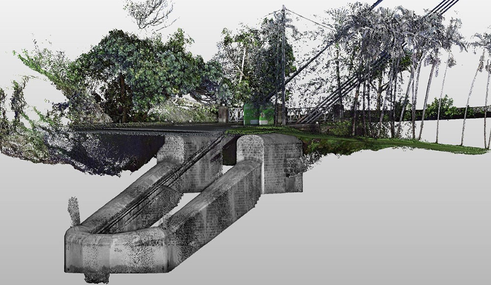
Rivière de l'Est suspended bridge
Complete 3D scanning of the bridge for monitoring purposes.
-
Area of intervention
La Rivière de l'Est
3D scanning
Saint-Denis CHU covered medical catwalk
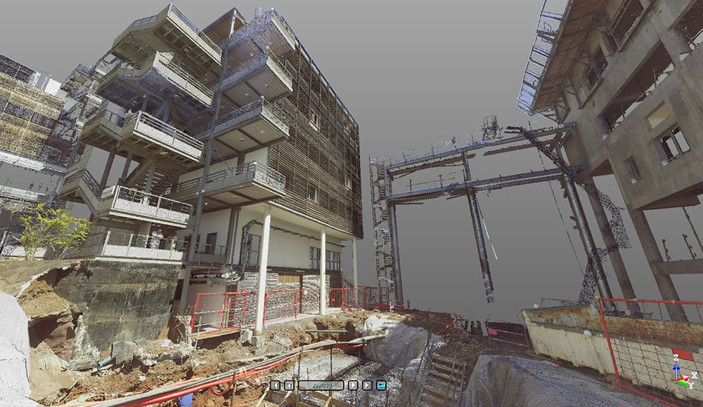
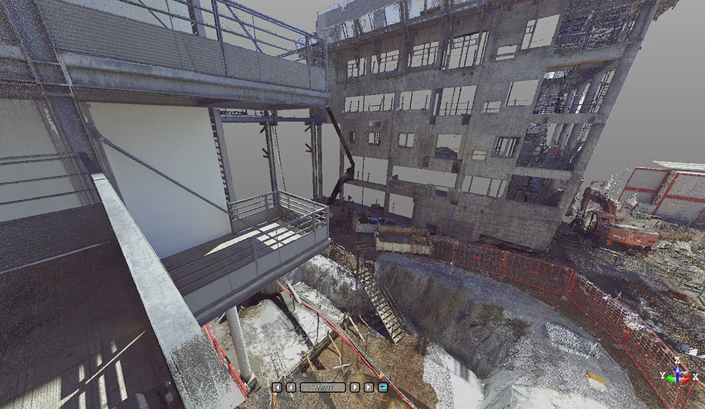
Insertion of a 3D project into a point cloud for digital implementation control prior to construction.
-
Area of intervention
Saint-Denis, Reunion Island

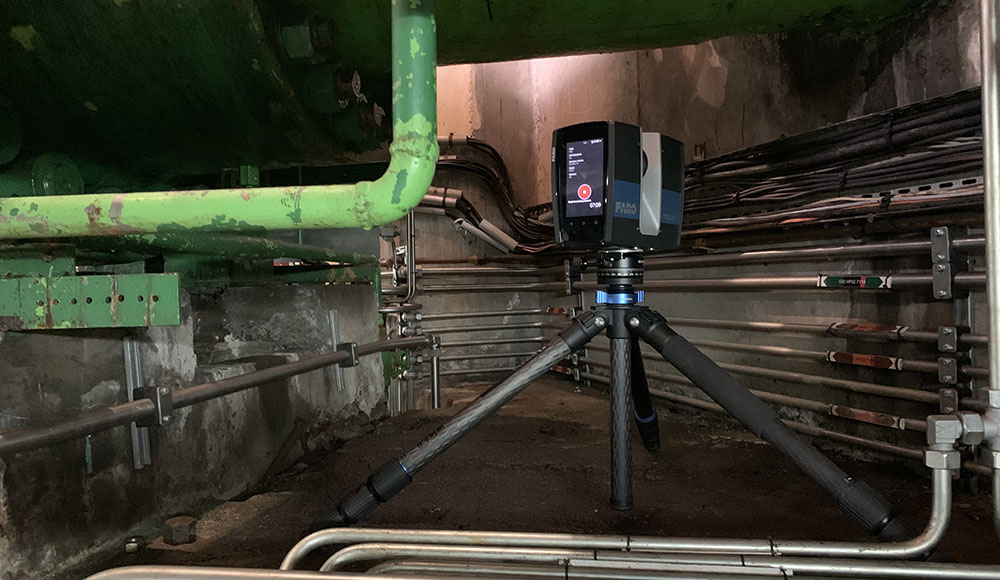
3D scanning
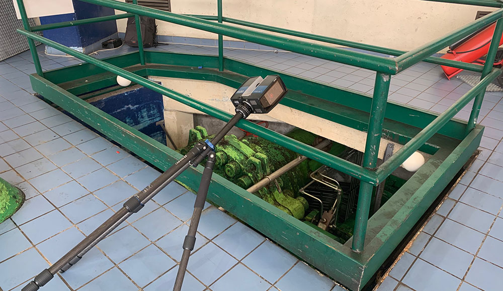
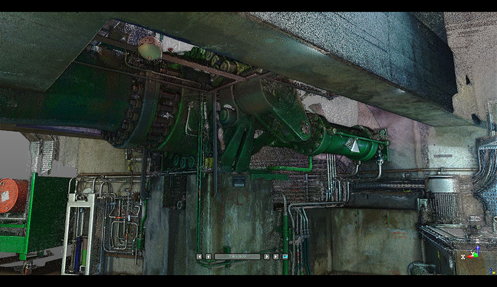
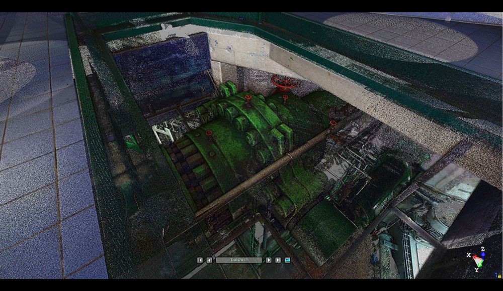
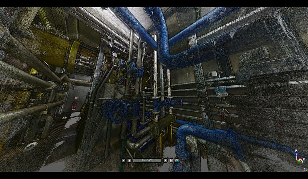
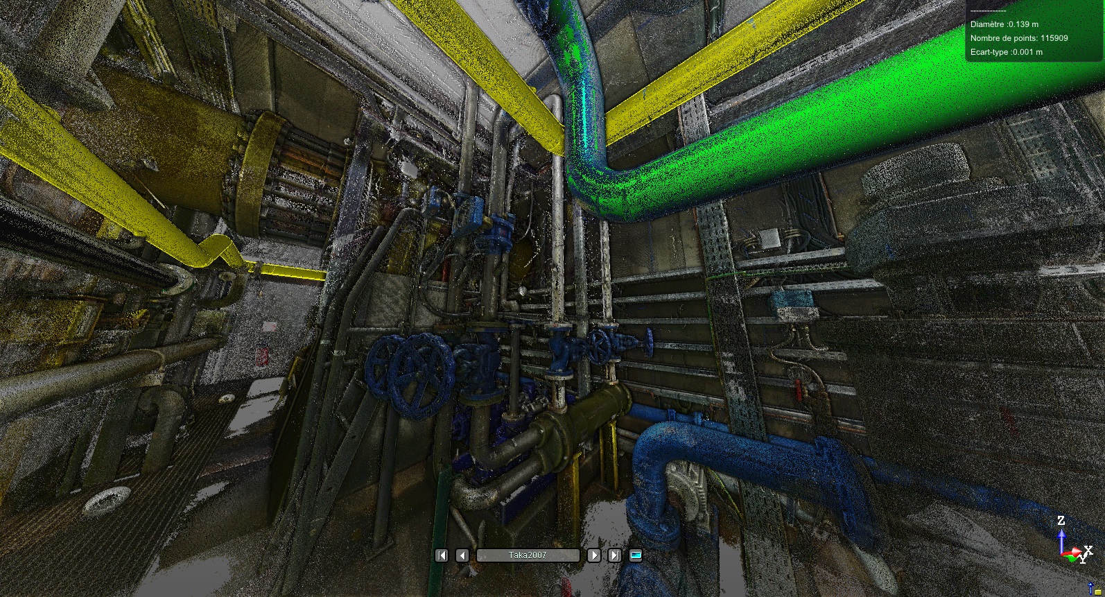
Takamaka and Rivière de l’Est hydroelectric power stations
Shut-off valves digitization for replacement – Exemple of pipes 3D modeling.
-
Area of intervention
Rivière de l'Est - Takamaka
Reunion Island
3D scanning
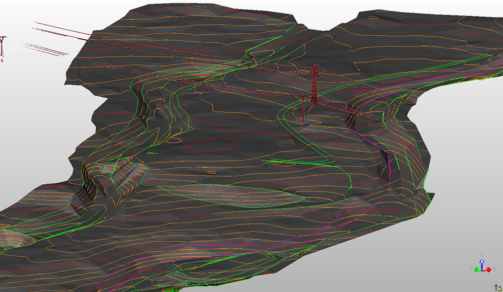
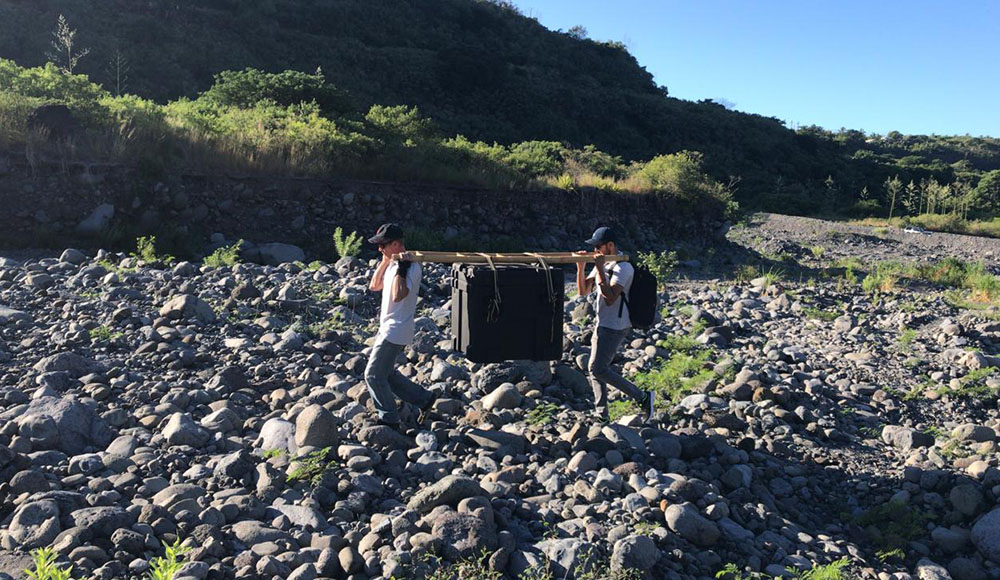
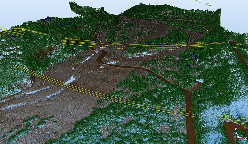
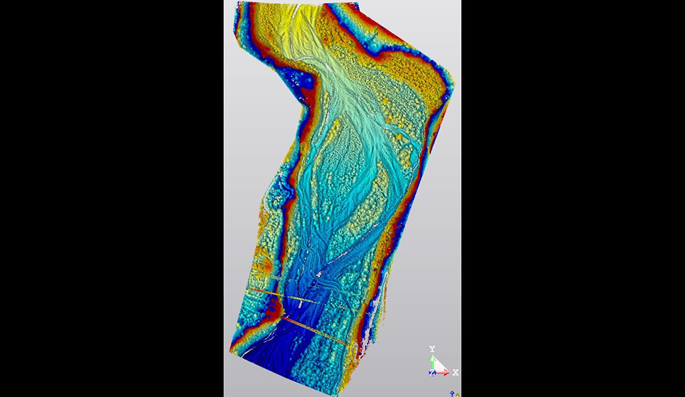
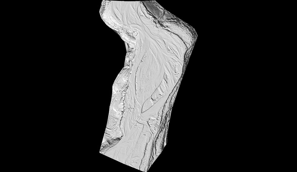
Drone-based LiDAR survey
Creation of a Digital Terrain Model (DTM) after vegetation filtering.
-
Area of intervention
Ravine des Cabris, Reunion Island
3D scanning
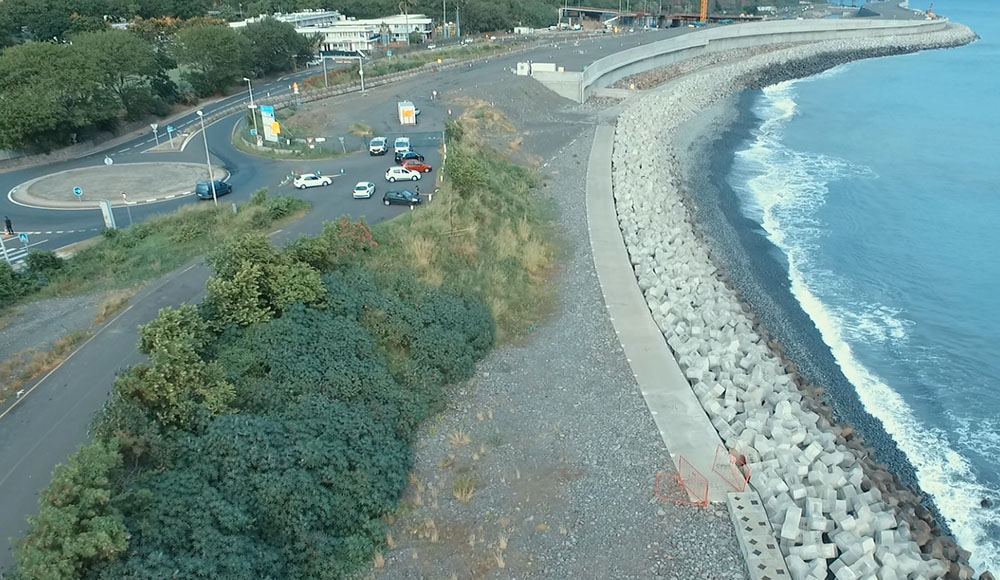
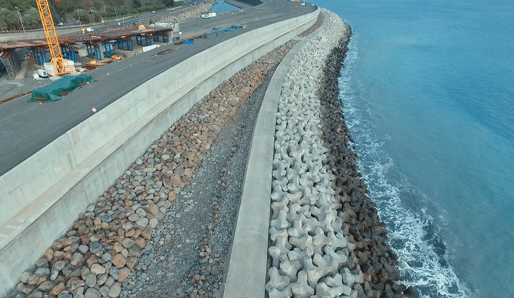
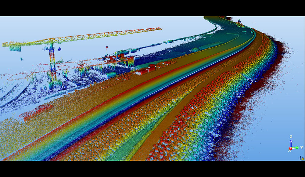
NRL – Embankments geometrical monitoring
Drone-based LiDAR survey for the embankments stability monitoring of the NRL.
-
Area of intervention
Reunion Island
3D scanning
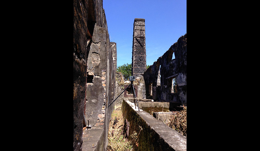
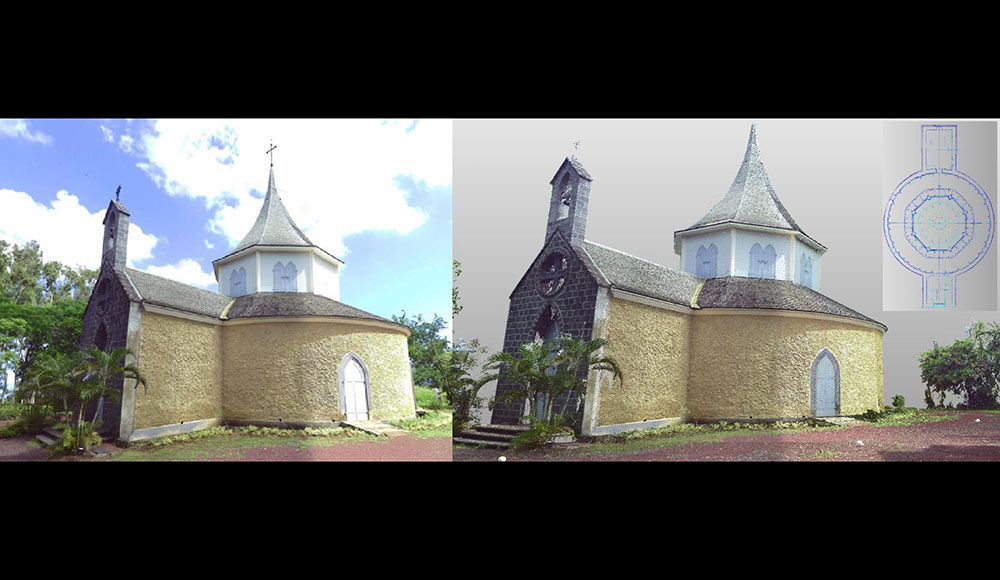
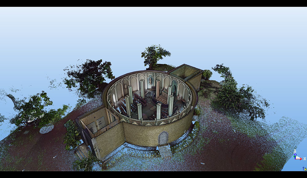
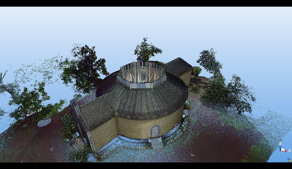
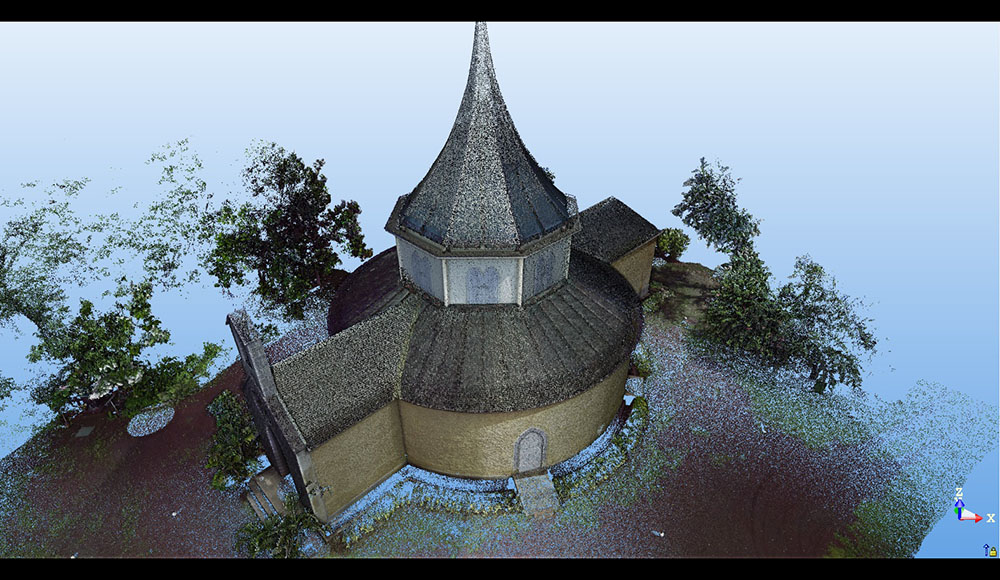
La Chapelle Pointue
3D scanning of Chapelle Pointue for heritage conservation purposes and creation of a 2D plan.
-
Area of intervention
Villèle - Saint Paul
Reunion Island
3D scanning
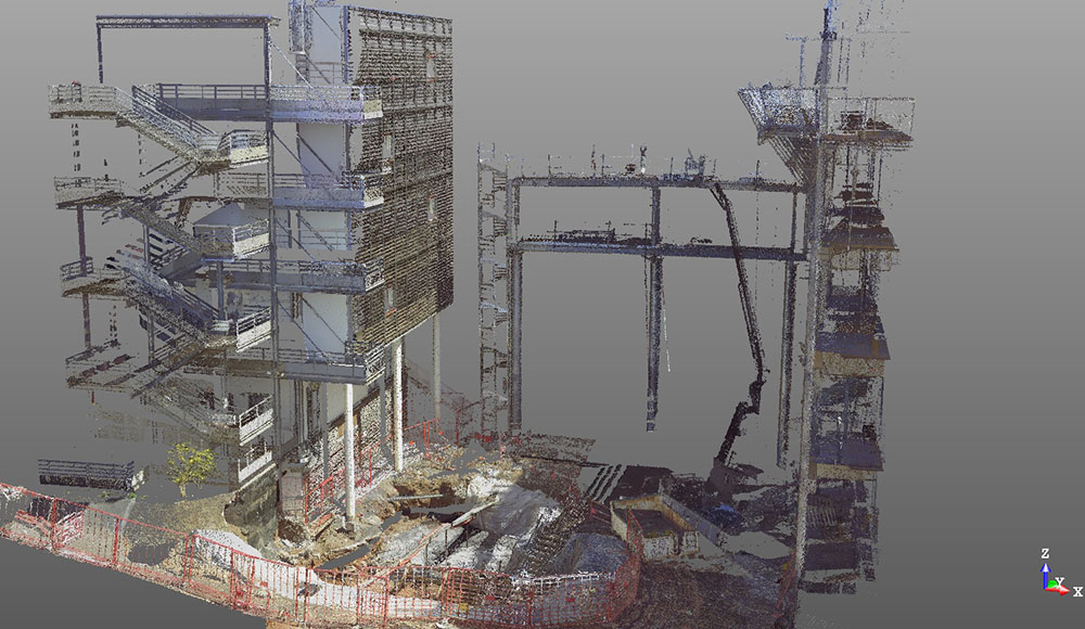
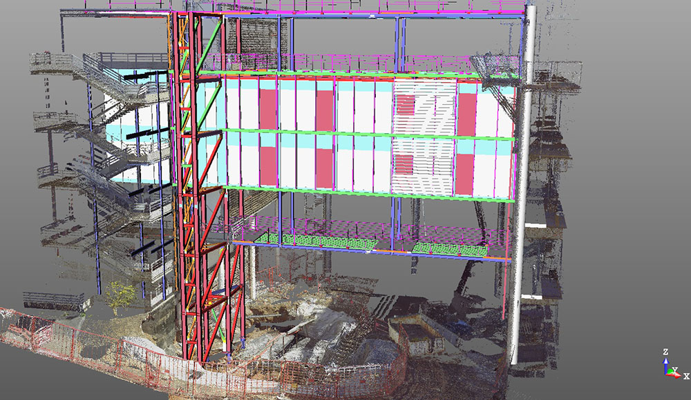
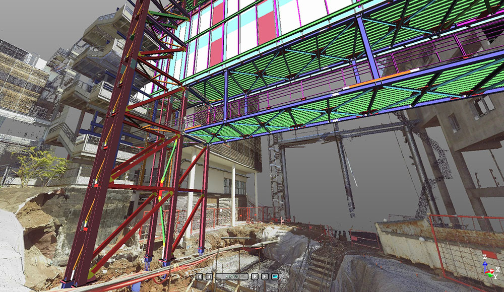
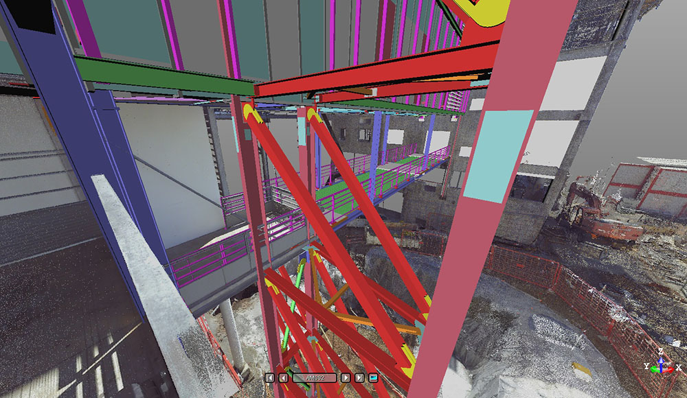
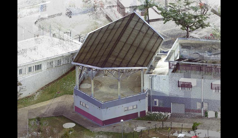
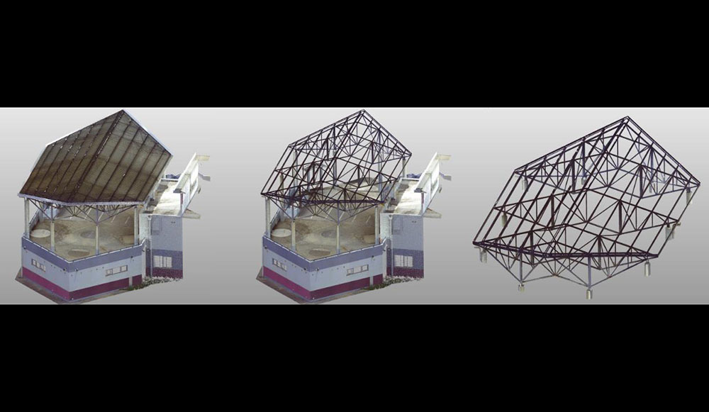
Steel frame
3D scanning for steel frame extraction prior to structural analysis.
-
Area of intervention
Saint-Pierre, Reunion Island
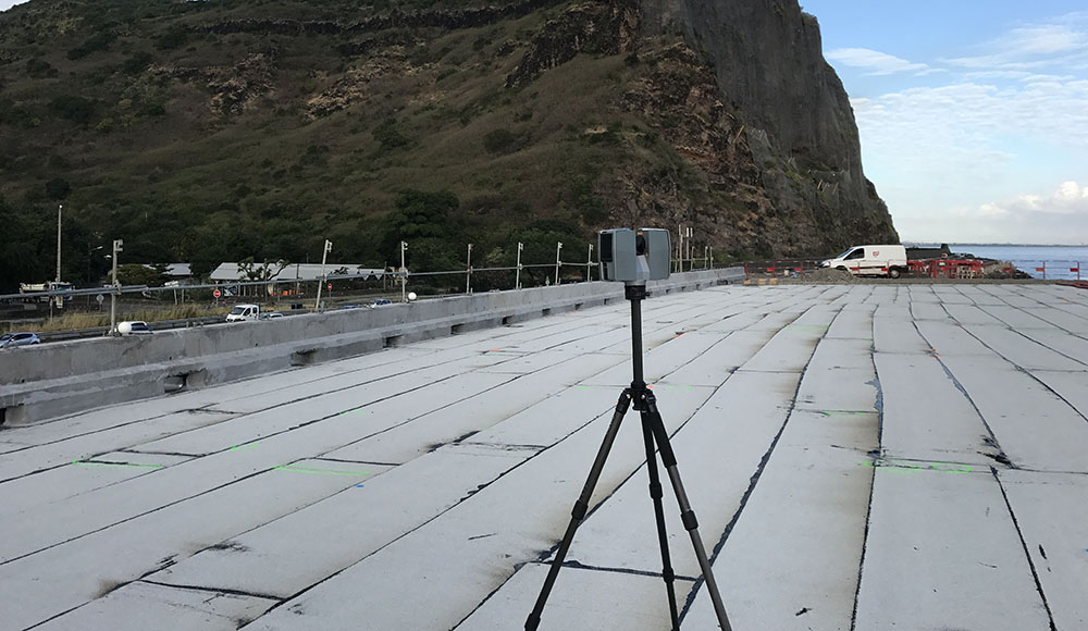
3D scanning
Ouaki's water apron
LiDAR survey for the study of Ouaki's water apron removal and the creation of a crossing structure.
-
Area of intervention
Saint-Pierre, Reunion Island
Cookies use
This website uses Google Analytics cookies in order to measure this website trafic.
Measured data are anonymous and only concern our website. Do you accept their use during your navigation on our website ?